Average Birding
The third in a series of posts detailing a trip to mid-Wales in August/September 2020.
The story so far
We've visited two excellent Oak woodland reserves near Llandovery. And we've had some tremendous Dipper encounters, along with some distant Whinchats and flighty Flycatchers near Sugarloaf.
Now, however, we've setting up camp in a self-catered cottage in Rhayader for a week. Will we find anything more? We doubt it, but we'll know where to go come next Spring.
To Rhayader
We drive to Rhayader from Celyn Farm, stopping in Llandrindod Wells for lunch, a visit to the National Cycle Museum and a bit of laundry. Our keenness for cleanness is unneeded though - it transpires there's a laundrette not two minutes walk from our Rhayader residence that AB2's internet searching did not reveal. Oh well.
Rhayader's easily our favourite base of operation. It's self-catered, so we can cook an evening meal. The town's full of pubs for a pre-dinner pint or two, and there are walks we can do from the doorstep. Finally, we've got an extra Sophie coming along for this bit, and she's bringing an adorable little Spaniel named Spoon.
This part of the trip is a bit different - we don't explore as many places as we perhaps could, but instead pretend we live in Rhayader full time, and treat the nearby places like our local patch.
We find one particularly special reserve nearby, and a few other spots that are worthy of a trundle around if you want to play the same game we did.
Let's start with our favourite find: Gilfach Nature Reserve.
Gilfach #1: Afon Marteg
I think we ended up coming here on two separate occasions in the end. If we didn't have so much FOMO about missing other things we could easily just have come here every day!
Gilfach is nestled in the Marteg valley just to the North of Rhayader; it's barely a five-minute drive out of town; we wouldn't even mention it but for the daily excitement of trying to navigate around the clock tower junction in Rhayader's centre. What a nightmare.
You can park in a couple of official places - just as you leave the A470, or, if you prefer, you can drive up to the visitor centre. If you're feeling indecisive, there's also an opportunity to park off to the side of the road half-way between the two; this doesn't appear to be officially sanctioned though!
We dropped the car off in the visitor centre for both visits; the trails we were initially interested in started there. This might not be a wise idea if you're not a reasonably confident driver - it's a single track road with some fairly serious gradients involved.
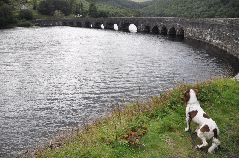
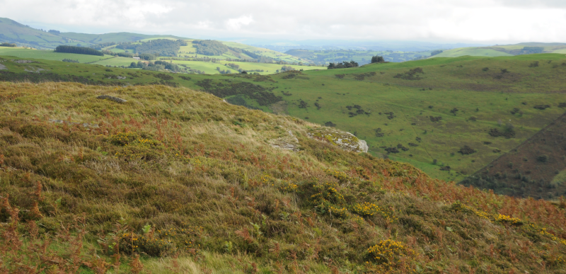
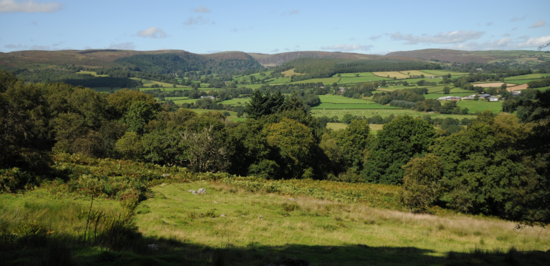
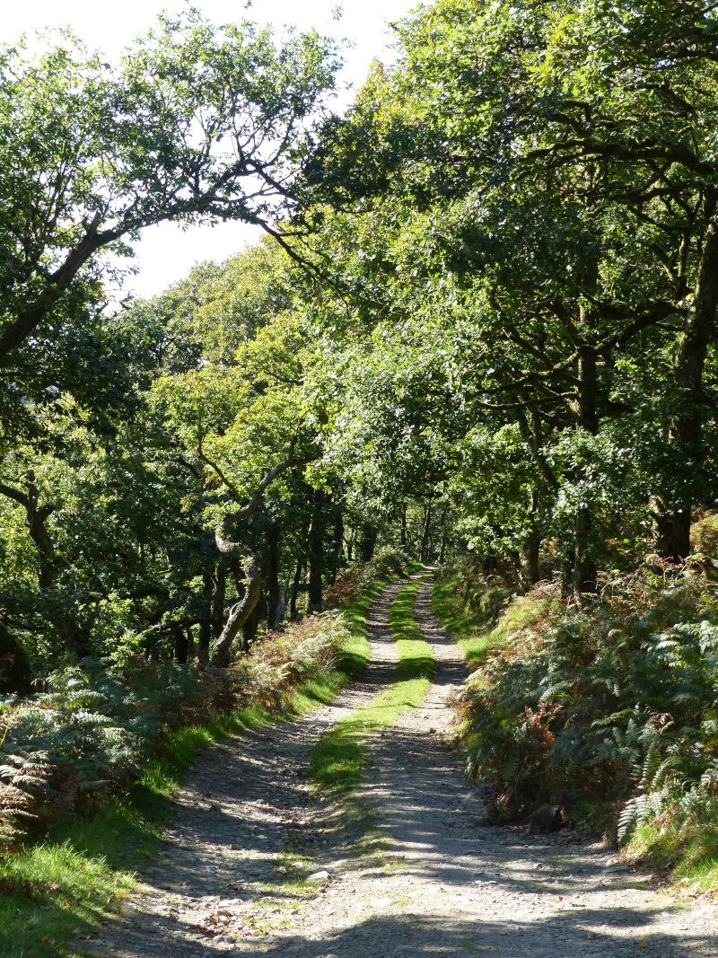
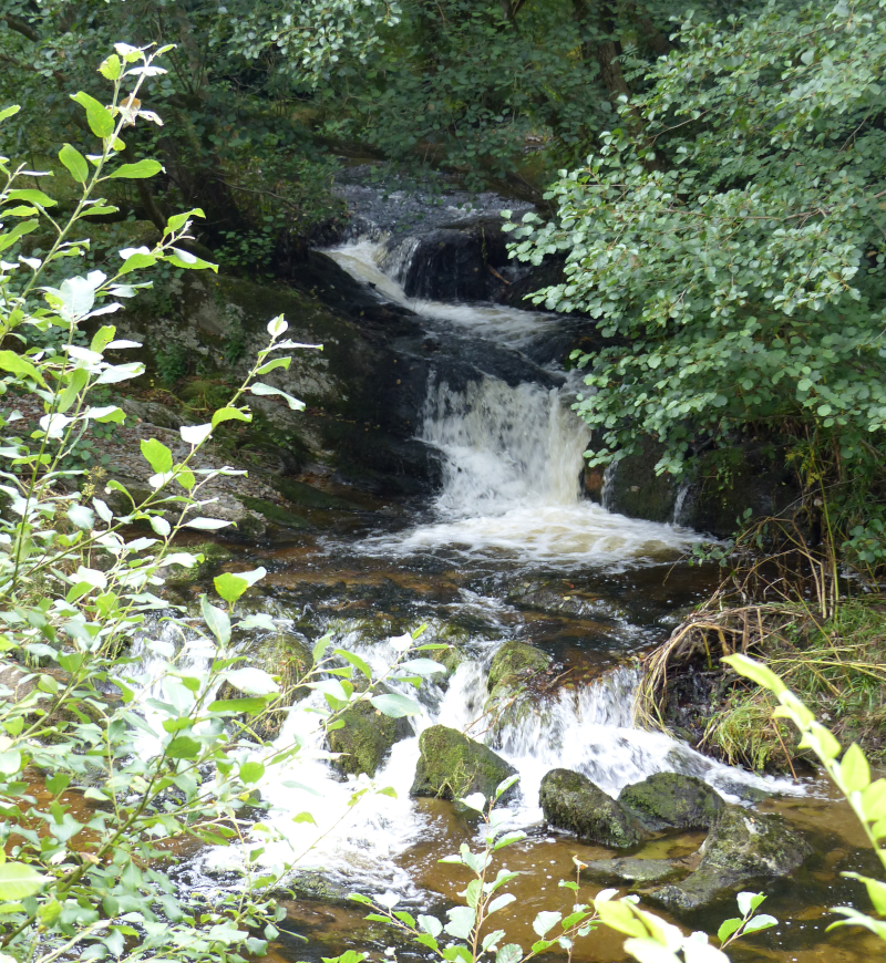
The reserve has a few different options for walks. On our first visit, we explore a trail that goes along the North side of the Afon Marteg. Before we get there though, we must first descend from the car park - and my goodness, the views are fantastic. We pass by the Dipper hide as we cross the river; it seems aptly named, this river looks built for Dipper. And we have, in Sophie, someone for who the existence of Dipper (and non-rubbish binoculars) is quite new.
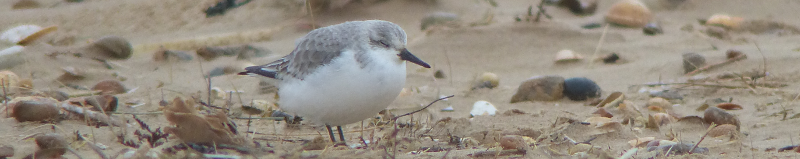
Remarkably, I think I've got a Dipper from the bridge, but it flits before I can get either AB2 or Sophie onto it. It doesn't go far though - we re-find it from the first field of our trail down the river. This is a more popular find than I expected; if only we'd been here in Spring, we could probably have found Sophie a few more life-ticks.
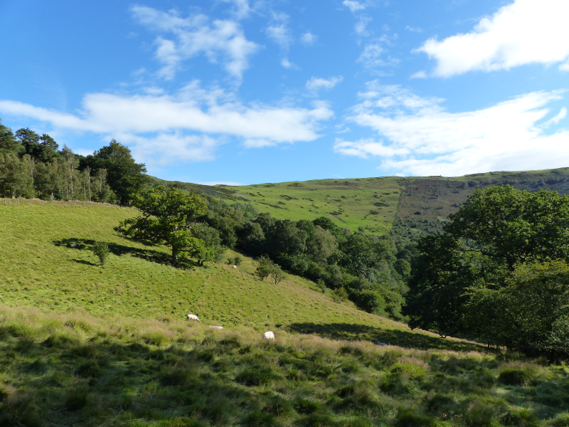
Ambling down the path takes us through a few places that look like they ought to be favourites of some of our previous target species; a post or two that could easily have had a Redstart on them; some scrub that could be a fine perching point for either Stonechat or Whinchat. Remarkably though, they are empty.
The river itself demands some attention - it plunges down a couple of noisy rapids that are potentially worthy of the name of waterfall, and there's a bit of the path that acts as a viewing area. Very nice indeed.
We follow the river until we reach a point where we can either decide to have a much longer walk, or cut back along similar but different river friendly path. We choose the latter, and it works well; we come across two or three foresting flocks of littlies that provide us with the usual Great, Blue, Coal and Long-tailed Tits, and, bringing up the rear, Nuthatch and Treecreeper. Also very nice.
We start to climb back up to the car park, and it's clear that a pesky knee is still present; irksome, but in the plan. We have a brief explore towards the Oak woodland part of the reserve but cut it short in favour of starting to think about lunch.
Gilfach #2: Oak Wood and Hill walks
We return a few days later, sadly sans Sophie and Spoon. Our aim here is to cover most of the trails we missed last time. We start with the Oak Wood Walk, which is shorter than we thought - we'd have been done in less than ten minutes, but on our way there, we come across someone who looks like they might know what they're doing, and end up having a cracking chat about this reserve, reserves nearby, reserves we went to last week that this person also knows about because they've been involved in conservation for ages, and the enthusiasm is bubbling off them (and us) about how great Gilfach (and in general this part of the world) is. We forgive the Oak walk for being, in comparison, a bit dead (we're definitely too late for flycatchers - even our local expert's only seen one female since mid-August).
Post Oaks, we head down and across the river to try out the Hill walk. We get stopped a lot by an area of the hillside that's just sitting out of the wind, where a number of young birch trees have managed to take root. There are several littlies making interesting noises in that area; definitely some Goldfinches, but some others as well - maybe Siskins? The sun's in an unhelpful place, though, so all we get is distant silhouettes. We march onward, confident that we'll get a better view of that area from further up the hill.
After a solid first bit of climbing we do indeed get an improved angle of attack, but, of course, everything that was previously there has now gone silent, and all the exciting movement that was distracting before has ceased. Even adding patience doesn't work - whatever that flock was has moved on.
We continue uphill. Our only accompaniment here is Ravens. Oh, and, if our ears don't deceive us, Stonechats, although unusually they do a superb job of staying out of sight.
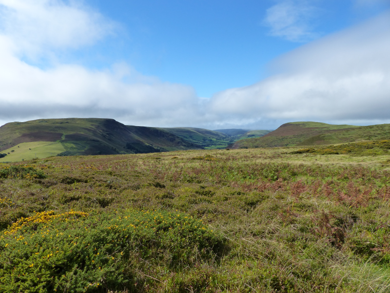
We eventually reach the top of the hill, although it's less of a summit and more of a table - the moor stretches away from us without losing too much height to the North. The views down the Marteg and Wye Valleys are worthy of letters home though. We cheat and take photos instead. And then eat victorious cheese and pickle sandwiches. This is the life.
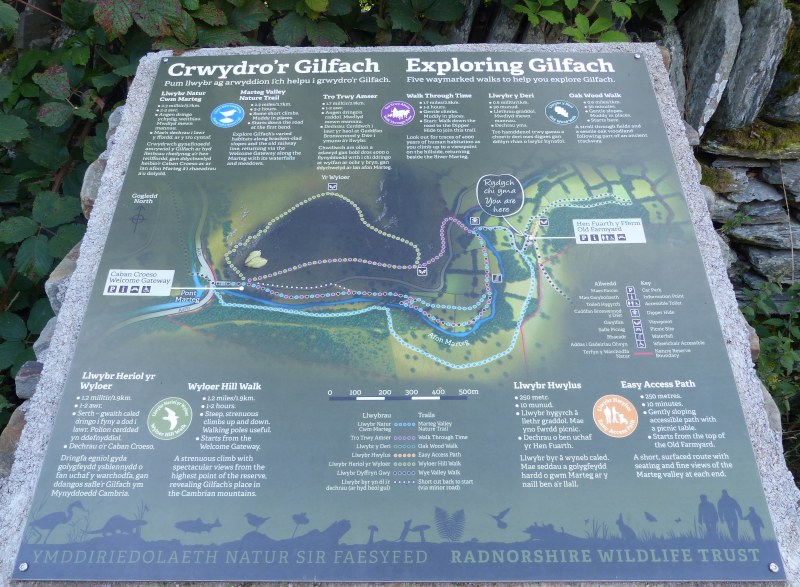
On a tricky descent back down to what the trail map names the "Welcome Gateway" (is that like a Welcome Break services?), we finally clap eyes on our Stonechats - they were substantially below us; we'd have needed to nearly fall off a cliff to see them from where we were. As we reach the gateway, there's an interesting little exhibit about the reserve, and some picnic tables. The trees and scrub nearby are choc-a-bloc with Chaffinches; what is it with Wales and Chaffinches? Can't remember when I last saw enough Chaffinches to call them a flock in England.
From here we can either walk back up along most of our first visit's Marteg Trail, or we can try its Southern equivalent. This involves us leaving the reserve, and we can't help but notice the existence of a tiddly footbridge across the Wye just across the road. Unable to resist the temptation of such a bridge, we risk life and limb crossing the A470 (not actually that bad - it isn't too busy) to go and have a look.
There's not a lot on the river, but again it's painfully scenic. After a bit of hanging about we manage to discern a Red-breasted Merganser dabbling just upstream, but of our usual Dipper and Grey Wagtail expectations there is only disappointment.
We head back to the reserve, entering via a small gate to the North of the road entrance. A lost looking woman is there. "Is it far back to the car park from here?" "You're literally a couple of minutes away - once you're through that gate, turn right twice and it's right there"; "Oh, what a relief, I thought I was totally lost"; "Heh, well, you're alright, not far now!"
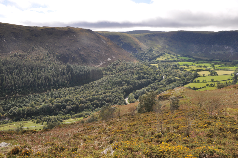
After that exchange, we're wondering if this part of the walk is more difficult than advertised. After ten minutes of walking along what we later discover is the old Marteg Valley railway line, all we're sure about is that it is very muddy. It isn't lose-your-boots muddy though.
After passing up on an opportunity to die young (the old railway bridge isn't just disused but actively condemned; do not go near) we start to climb away from the river up the hill we've just had such a nice view of from the hill walk. On this side though, we're much closer to the river, and just as importantly, the trees that follow it. We take a brief break on a further picnic bench with a view over a mostly open field that backs on to the wet woodland; pleasant but a bit dead, more Chaffinches are all we clap eyes on.
Eventually the path brings us back to the car park, and we head out again, satisfied that we've found an absolute gem of a reserve.
RSPB Carngafallt. Maybe.
One further thing our friendly encounter at Gilfach tells us: with every attempt to say the name of this place, we've been a long way off.
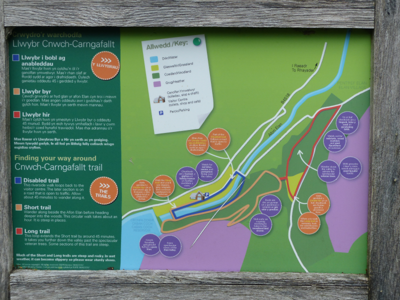
We think we visit Carngafallt twice - assuming the reserve is roughly the area marked Carn Gafallt on our OS map.
We're not exactly sure what the boundaries of the reserve are - there's little indication on the RSPB website which also has no trail maps, or really any useful information other than that the Elan Valley visitor centre is the nearest place to park.
On our first visit we take that advice, and find an RSPB person inside the visitor centre. Unsurprisingly he is rather swamped with folks wanting to ask him questions. We decide we'll be able to work it out. How hard can it be?
We head out in the hope of using our OS map's footpaths as a rough guide for getting around what we think is part of the reserve. Although if we go by the OS Map, most of the nearby hillside and a substantial tract of the land between here and Rhayader is "Carn Gafallt".
We end up crossing the reservoir's outflow and heading towards Elan village on a path that's at the edge of Cnwch Wood. This slowly curves around to the right; we choose not to cross a small watercourse to intersect with the nearby road.
Shortly we arrive at a big sign. It coincides with where we think the path ought to go; but the sign is clear - it doesn't any more. You must go right, and further upwards. OK - we're not going to argue (although, you know, we could - OS footpaths need defending), we sort of wanted to go that way anyhow. This path continues steeply, but starts to take us towards the edge of the wood, which is, handily, also the ridge of this little hill. Excellent views towards, er, Carn Gafallt, and some accompanying meadows are obtained.
We plough on through the wood and eventually reach an official-looking stile. Oh, how exciting, we've managed to reverse our way on to an actual trail. Even better, the trail features a collection of information panels about the wildlife of Cnwch Wood.
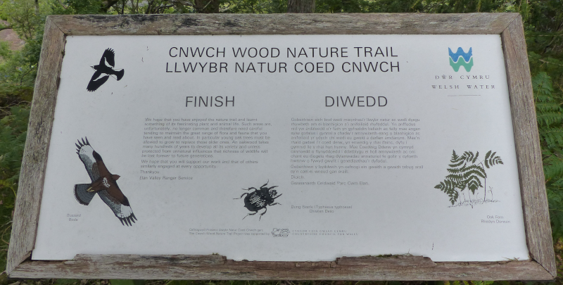
We don't see much of the wildlife other than the trees - even our usual flocks of friendlies are absent. The panels seem pretty confident that we'd see Redstart, Pied Flycatcher and even Lesser-spotted Woodpecker (with the tit flocks), but they are old; we can tell by the sheer amount of text on them, and the density of the language within. Reading them is like watching an early David Attenborough series, where if you don't pay attention for a couple of minutes you miss some seriously important steps of how life evolved on earth, and you're now stuck forever with Coelacanths. Dear panel makers everywhere: more like these, please!
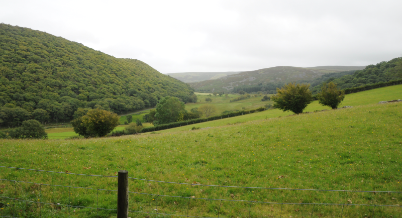
The panel collection more than occupies us as the path switchbacks its way down through the hill-wood. Is this an Allt, we wonder? We then enjoy a pleasant walk along the river at the bottom; no Dippers, no Grey Wagtails. Good amounts of noise and spray from the dam though, and some excellent milling around of sheep. A few footsteps more and we're back to the car. Did we visit the reserve or not? We'll never know.
We enter the reserve again (maybe) a couple of days later on a longer walk. We've followed the Wye Valley Walk out of Rhayader to the South. It's taken us through some woodland, across the Afon Elan and up the side of quite a steep hill. It's also delivered us some beautifully-lit Nuthatch, Treecreeper and Goldcrest in some trees along the Wye, and a forest flock that I'm confident had something more interesting in it than we actually managed to see.
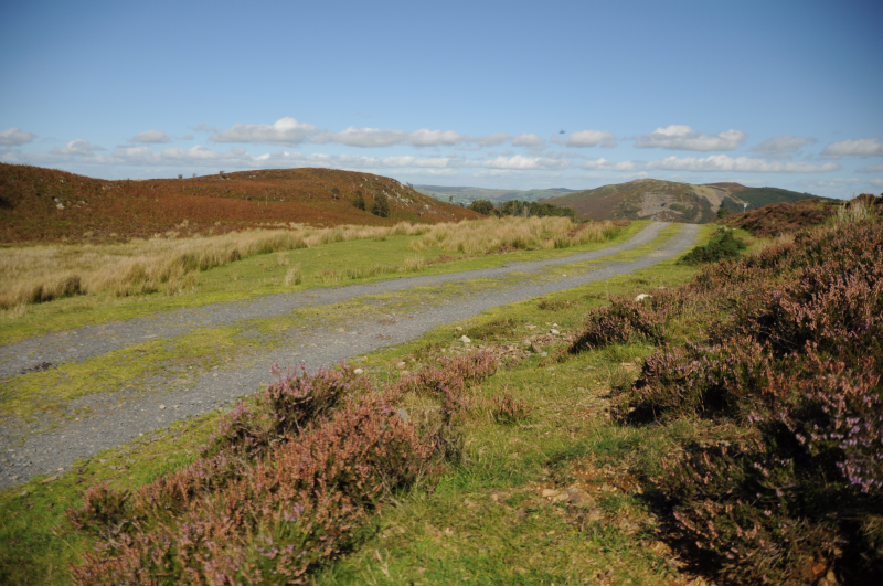
As we reach the top of the steep hill, there's a windmill, some other hikers and an opportunity to continue to follow the Wye Valley Walk East, which we decline. We instead head West towards Carngafallt along what seems like a decently maintained track through near featureless moor. The long-dashed crimson line on the OS map isn't lying, for once. Progress here is speedy but for distractions from Stonechat (sitting in bracken that could be Whinchat territory) and lunch.
This track eventually takes us through the halo (or possibly a wreath) of Oak woodland that rests on the slopes of the hill. This is full of bird noise; we hear several Great-spotted Woodpecker, Nuthatch and there's an occasional Song Thrush blasting out something electronic as well.
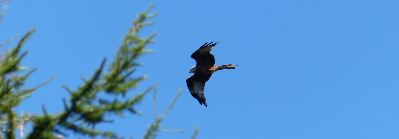
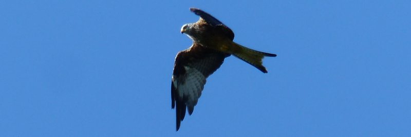
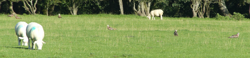
The path eventually reaches the road that connects Elan Village with Llanwrthwl - we follow this until the bridge over the Elan. From there it's wall to wall Red Kites. Before we even cross there's a field with perhaps twenty Kites poking about in it - afterwards, almost every bird we see is a Kite, with occasional exceptions for Raven and Buzzard, who seem almost apologetic not to be part of the crowd.
A short walk through the pleasant Rhayader Tunnel reserve and we're back into town, ready for a pint.
Carngafallt. We think we visited it. We'd definitely have another go at it in the Spring.
Honorable Mentions
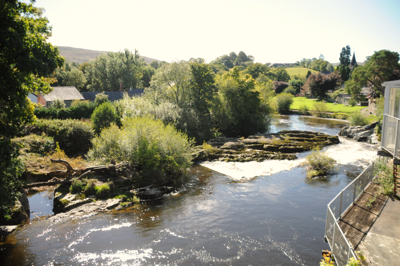
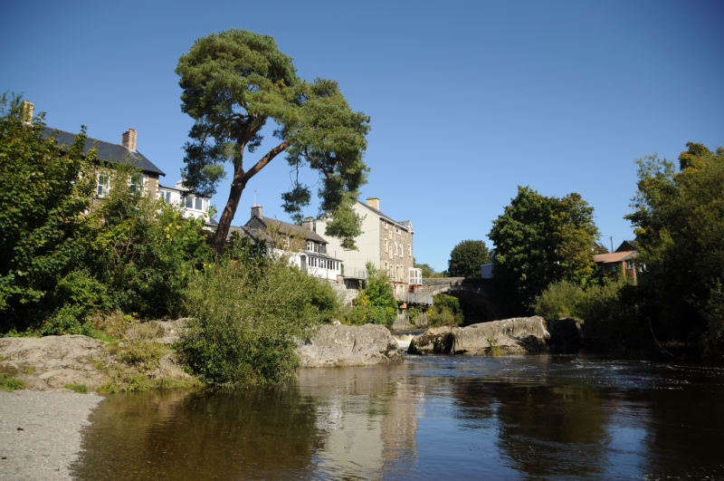
Rhayader town itself is not without a pleasant walk or two; both sides of the
river have excellent paths, even if feels like it's one bridge short. Remarkably
we didn't find a Dipper anywhere along the Wye, but if we had to guess, we'd
point at where Nant Gwynllyn empties into it just North of the bridge.
The Elan reservoirs are beautiful...but, like many reservoirs, a bit dead - I'm not sure we saw a single bird on or over any of the reservoirs; not even a Mallard!
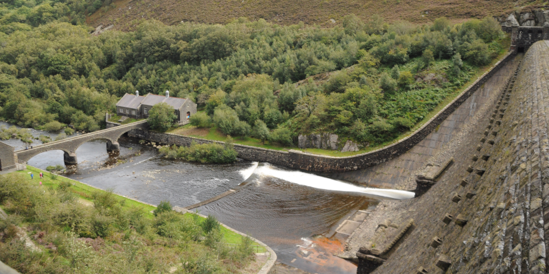
We did enjoy two tours around them - once on a bike, once in a car. There were good birds of prey along the ridges, but not a lot else. In particular, the views from the upper Claerwen Dam car park are spectacular. We picked up more birds of prey there, the best being a Sparrowhawk doing an excellent impression of a Hen Harrier.
We'll definitely be back, even if it's only to have dinner at The Triangle Inn.